
Plan IGN
Have you ever wondered what it’s like to follow your nose along the flank of a volcano? Or to stretch out for a rest inside a crater after an invigorating walk? Now you can find out!
Unless you’d prefer to explore the Limagne Plain, taking in balcony view of the volcanoes from vantage points in completely unspoilt countryside? Best foot forward for a 360° experience of paradise for those who love the Great Outdoors.
From the Enval Gorge to the Vallée de Sans Souci, from the Étang Grand at Pulvérières to Val de Morge and the Volcans d’Auvergne Regional Nature Park beyond, there are no end of walks in Puy de Dôme waiting to be explored. Simply download our GPX tracks, pack your knapsack and get out there and explore the Terra Volcana countryside !

Plan IGN

Photos aériennes / IGN

Open Street Map

Départ Cellule (salle des fêtes). De Riom, prendre direction Aigueperse sur la D2009. Passer le pont de l’autoroute A89 puis tourner à gauche juste avant le pont de la voie ferrée à Pontmort, direction Cellule.
Dans le centrebourg, parking de la salle des fêtes sur la gauche, en face de l’église.
Prendre le chemin derrière la salle des fêtes. À la 1ère intersection, prendre le chemin enherbé à droite pour rejoindre un grand carrefour. Continuer tout droit sur la route qui passe à droite du cimetière (allée du Patural).
1. Au bout de l’allée, prendre à droite et franchir le pont. Après 400 m, tourner à
gauche rue du Chauffour, puis à droite à la fin de cette dernière. À 50 m, tourner à gauche rue de l’Écluse, rejoindre un chemin qui longe le ruisseau le Chambaron. À l’intersection avec le pont, prendre à gauche.
2. À la croix, tourner à droite, passer le pont de l’autoroute, puis prendre la 1ère à gauche. À 250 m, tourner à droite avant les arbres et continuer tout droit aux 3 prochaines intersections pour arriver à une intersection.
3. Prendre à gauche et rejoindre les maisons. Tourner à droite rue des Roses
jusqu’à l’avenue de Châtel-Guyon. Au cédez-le-passage, prendre à gauche avenue de Châtel-Guyon. Passer l’école puis tourner à droite rue Michel de
l’Hospital. Au bout de la rue, prendre à gauche rue Gambetta puis à droite à la croix. Remonter à gauche en direction de l’église.
4. Au stop, traverser la route puis s’engager dans la rue Pasteur. Au bout de la rue, prendre à droite au stop, rue Jeanne d’Arc. Continuer tout droit jusqu’à une fourche avec un noyer.
5. Quitter la route pour emprunter le chemin. Passer le pont de l’autoroute,
continuer tout droit, laisser un pigeonnier et traverser la D422. Au croisement,
prendre à gauche puis continuer sur le chemin jusqu’aux maisons. Prendre la 1ère à droite puis continuer en direction de l’église pour rejoindre le parking de la salle des fêtes.

Départ Cellule salle des fêtes.
De Riom, prendre direction Aigueperse sur la D2009. Passer le pont de l’autoroute A89, puis tourner à gauche juste avant le pont de la voie ferrée à Pontmort, direction Cellule. Dans le centre-bourg, parking de la salle des fêtes sur la gauche, en face de l’église.
À la sortie du parking, prendre à gauche sur la rue du Stade, puis tourner à droite au monument aux morts en direction de l’église. La contourner par la gauche. Prendre la ruelle, passer sous le porche à gauche, puis tourner à droite. À la croix, prendre à gauche et continuer sur la route jusqu’au pont, puis prendre à gauche. Longer le ruisseau jusqu’au bout du chemin puis prendre à droite. Passer un premier croisement, puis à 250 m, prendre la montée à droite.
1. À la croix, laisser sur la droite la table d’orientation et prendre la 1ère à droite. À l’intersection suivante, prendre à gauche puis à droite au séchoir à tabac.
2. Prendre à gauche et passer sous le pont SNCF. Continuer jusqu’à l’église de La Moutade et prendre à droite entre la dernière maison du bourg et le pont de la Morge. Laisser 2 chemins à droite, puis prendre le sentier sur la gauche dans le bosquet à l’entrée du champ.
3. Prendre à droite à l’intersection, (possibilité de faire un aller-retour sur le chemin de gauche pour aller jusqu’au pont romain à 50 m). À la sortie du
bosquet, prendre en face à l’intersection et rejoindre le pont SNCF. Passer sous la voie ferrée puis prendre la 1ère à gauche.
4. Longer la voie ferrée sur 750 m. Tourner à droite et longer le ruisseau. Rester
sur ce chemin, passer les tennis au pont à droite et franchir le pont. Rejoindre la rue Saint-Roch puis le parking de la salle des fêtes.

Départ Cellule (salle des fêtes). De Riom, prendre direction Aigueperse sur la D2009. Passer le pont de l’autoroute A89 puis tourner à gauche juste avant le
pont de la voie ferrée à Pontmort direction Cellule.
Dans le centre-bourg, parking de la salle des fêtes sur la gauche, en face de l’église.
Passer entre la salle des fêtes et l’école, prendre le chemin derrière la salle des fêtes. À la première intersection, prendre à droite. Au carrefour, continuer tout droit sur la route qui passe à droite du cimetière (allée du Patural).
1. Au bout de l’allée, prendre à droite. Franchir le pont au dessus du ruisseau du Chant Laffont. À 400 m, tourner à gauche rue du Chauffour puis à droite au bout de la rue. À 50 m, prendre à gauche rue de l’Écluse, rejoindre le chemin qui longe le ruisseau de Chambaron.
2. À l’intersection avec le pont, prendre à gauche puis continuer tout droit jusqu’à ce que le chemin rejoigne l’autoroute (laisser le pont à droite).
3. Prendre à gauche le long d’un ancien mur. Devant le portail du château de Saulnat, prendre à droite chemin de l’Enclos. À l’intersection avec la croix et la tour carrée, prendre à gauche. Traverser la D422 puis continuer tout droit en laissant un chemin sur la gauche.
4. Au croisement, prendre à gauche puis continuer jusqu’aux premières maisons.
Prendre la première à droite puis continuer en direction de l’église pour rejoindre le parking de la salle des fêtes.

Départ Eglise. De Riom, suivre direction Saint-Bonnet. Dans le bourg, tourner à gauche avant l’église.
Prendre la rue qui longe la salle des fêtes, tourner à gauche au stop. À gauche avant le pont, longer le ruisseau jusqu’à une intersection.
1. Prendre la passerelle à droite. Tourner à gauche, à la fourche, continuer à droite. Prendre la 1ère à droite et rejoindre la route. La traverser, laisser 3 chemins et continuer jusqu’à un croisement.
2. Prendre à gauche, puis 2 fois à droite. Au croisement, à gauche rester sur le
chemin. Au bout, prendre à gauche à l’intersection. À 300 m, tourner à gauche et remonter en direction des vignes. Rester sur ce chemin jusqu’à la borne d’information «culture de la vigne», tourner à droite. Continuer jusqu’à la route.
3. Prendre deux fois à droite. Longer le fossé et le traverser à la buse, puis à
gauche. À 400 m, monter à droite. À l’intersection, prendre à droite.
4. Au bâtiment, prendre à gauche. Tourner à droite après la ligne haute tension,
puis à gauche. Poursuivre jusqu’à la route. La traverser et continuer sur le chemin à gauche. Au bout, prendre à gauche jusqu’à la route.
5. Traverser la route, prendre à gauche. Après le garage Renault, deux fois à
droite. Suivre le thermal express en direction du complexe sportif. Traverser
et prendre la route de Riom jusqu’à l’office de tourisme. Passer devant la piscine et suivre la rue de la Pérouse. Tourner à gauche dans la prairie, suivre Le Sardon. Chemin de la Conche, tourner à droite puis allée des Noisetiers. Au bout de l’allée, prendre à gauche pour longer la D227. Au rond-point, à gauche direction Châtel-Guyon. À 300 m, à gauche et continuer jusqu’à la route.
6. Traverser la D227 et continuer tout droit. À l’intersection, prendre à droite
puis à gauche. Continuer jusqu’à la D15, prendre à droite, au passage pieton,
prendre le chemin à gauche. À la croix, continuer tout droit rue de la Croix de
Magne.
7. À l’intersection, prendre à droite, puis laisser 2 chemins à droite et rejoindre
les maisons. Tourner à droite rue des Roses puis à gauche chemin des Roses. Au cédez-le-passage, prendre à gauche av. de Châtel-Guyon. Passer l’école,
tourner à droite rue Michel de l’Hospital. Au bout de la rue, à gauche rue Gambetta, puis à droite juste avant cette dernière. À 100 m, tourner à gauche et rejoindre le parking.

De Riom, suivre direction Saint-Bonnet-près-Riom sur la D2144. Dans le centre-bourg, tourner à gauche juste avant l’église pour rejoindre le parking.
Prendre la rue qui longe la salle des fêtes puis descendre à gauche au stop. Au ruisseau (le Sardon), prendre le chemin à gauche avant le pont.
1. Longer le ruisseau jusqu’à une intersection avec un grand saule pleureur. Prendre à droite sur la passerelle et traverser le ruisseau. Tourner à gauche
puis, à la fourche, continuer sur le chemin le plus à droite. Prendre la première à droite pour rejoindre la route. La traverser et continuer tout droit jusqu’à un croisement de chemins après avoir laissé 3 chemins latéraux.
2. Prendre à gauche au banc puis 2 fois à droite. Au croisement de chemins, prendre à gauche et rester sur le chemin enherbé jusqu’à la route.
3. Prendre à droite sur la route puis prendre la première à gauche. Rester sur ce chemin et délaisser les chemins sur la gauche jusqu’à une intersection en T avec un portail métallique.
4. Face au portail, prendre à gauche puis à gauche pour rejoindre le pont. Le franchir puis prendre à droite puis encore à droite juste avant la croix. Rejoindre le parking en tournant à gauche avant la salle des fêtes.

Départ Eglise. De Riom, suivre direction Saint-Bonnet-près-Riom sur la D2144. Dans le centre-bourg, tourner à gauche juste avant l’église pour rejoindre le parking.
Prendre la rue qui longe la salle des fêtes, puis tourner à gauche au stop. Au ruisseau (le Sardon), prendre le chemin à gauche avant le pont.
1. Longer le ruisseau, laisser 2 chemins à gauche puis remonter en direction de la D2144 sur 900 m. La traverser et poursuivre le chemin en face sur la droite. Prendre la première à droite et, en haut de la côte, continuer à gauche et longer la noyeraie.
2. Prendre à gauche pour récupérer une route en contrebas. À la route, tourner à
droite puis à gauche sur un chemin à 200 m.
3. Longer l’autoroute sur 200 m et prendre la première à gauche. Continuer tout droit jusqu’au stop, puis prendre en face rue Francisque Gaillot. Faire 500 m.
4. Tourner à gauche rue de l’Enclos. Continuer à droite jusqu’à une ruelle étroite. Au bout de la ruelle, prendre à droite puis à gauche, juste avant l’église pour revenir sur le parking.
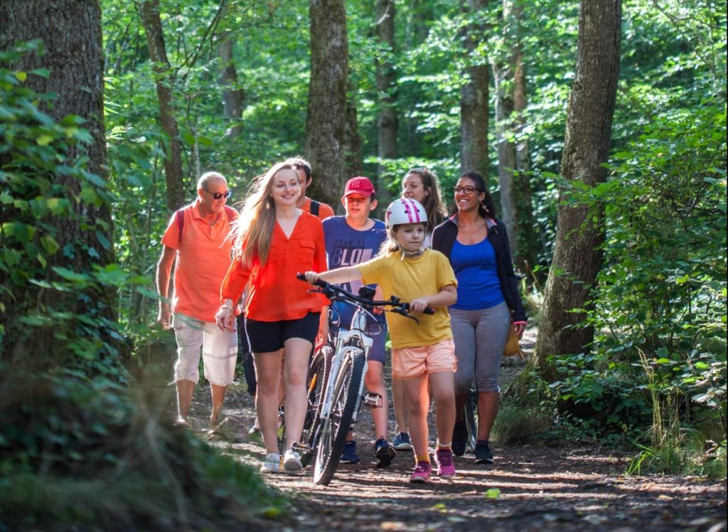
Looking for a family-friendly ramble with your children and grandparents ? Want to get a breath of fresh air with your friends ? Or are you out to push yourself to the max on a demanding mountain walk ? There is a huge variety of footpaths on offer here, all waymarked and regularly maintained. In Puy de Dôme you can follow a gentle ramble as easily as a long-distance footpath.
The important thing is to choose carefully, to avoid biting off more than you can chew. Keep in mind the length in kilometres and total ascent in metres given for each walk. Choosing a walk in Puy de Dôme that’s within your capabilities will bring the beautiful scenery and wildlife within easy reach, making the experience all the more enjoyable.
Whether you’re striking out on a big hike or pootling along on a gentle stroll in Puy de Dôme, it’s always a good idea to prepare properly. Don’t forget : you’re in the mountains. Before you set off, check the weather forecast – and don’t start off too late in the day. Take a bag with water, a hat and sun cream. Even though it may not feel like it, the sun is very strong in the mountains.
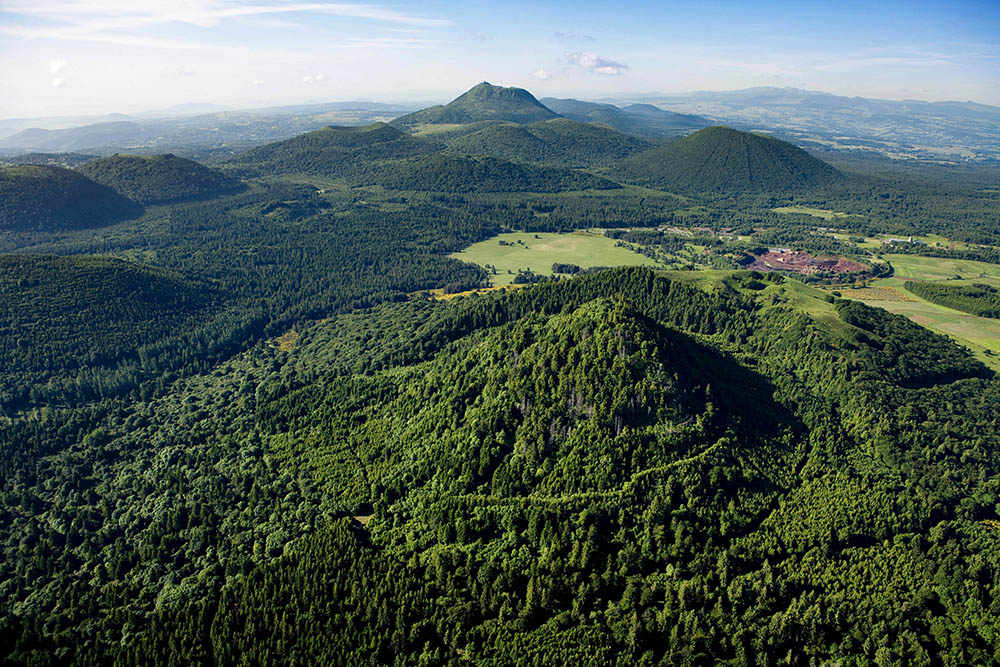
Wherever you’re out walking in Puy de Dôme, you can’t miss our sleeping giants, called Puys – the local name we give our mountains. Here, on the north face of this unique tectonic arena, listed by UNESCO as a World Heritage Site in 2018, the main peaks are Puy de Louchadière, Puy de Jumes et Coquille and Puy des Gouttes. And the endless views from the top are incredible – you won’t want to tear yourself away! One beautiful walk that starts in the hamlet of Beauregard gives you a wonderful introduction to these extinct volcanoes, rubbing shoulders with the famous Puy de Dôme just a few kilometres away. So set your alarm and make an early start – after all, it’s not every day you get to climb three volcanoes on a 15-kilometre walk!
A full-day walk ? A 2-day hike, camping overnight – or longer ? Our mountain leaders will give you an experience to write home about of the Chaîne des Puys Volcanoes !
“My favourite place in Terra Volcana ? It’s impossible to pick just one! Lots of beautiful places all over the area come to mind. I would have to say the summit of the Puy de la Coquille or Puy des Gouttes volcanoes (because of the stunning panorama you get), the peaceful Suc de la Louve beech woodlands and Latia woods (so much history!), and lastly, parts of the Chanat Forest, where there is such a rich biodiversity.”
Kévin CONILH – Qualified Mountain Leader – Empreinte Éducation Nature
Looking for a great walk near Châtel-Guyon ? Slip a bottle of water in you knapsack, lace up your walking boots and set off along the River Ambène !
At Enval, you follow this rocky river upstream, climbing through the chestnut forest, with gorgeous views along the way of the Château de Tournoël against a backdrop of the Chaîne des Puys Volcanoes.
And the views here are for everyone ! This protected nature area of special ecological, flora and fauna interest is accessible to walkers of all abilities.
There a lots of different footpaths – of varying lengths and difficulties.
So exploring here is a family-friendly activity too !
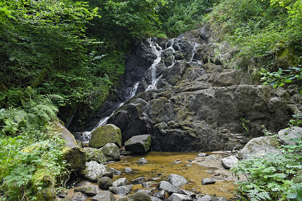
Need to cool down ? This walk takes you to the Petit and Grand Gornand waterfalls, and later ‘Le Bout du Monde’ (the End-of-the-World Waterfall) !
Did you know that the 19th century novelist Guy de Maupassant liked to come here ? He described the Gorge as “a curious stretch of valley, […] ending in a wild and magnificent gorge of a jumble of fallen and teetering rocks, cut by a stream that cascades over the giant boulders, forming a small lake in front of each one.”
Why not follow in his footsteps ?
My favourite place in Terra Volcana, if I had to pick just one, would be Enval Gorge. I love this place for all sorts of reasons. In summer the gorge is lovely and cool, and in autumn the oak and chestnut trees turn a beautiful golden colour. You can still walk there in winter, observing forest life by picking up the tracks of the wildlife that lives there. And in spring, the sunrise there is a sight to behold.
Didier SAUVESTRE
Qualified Mountain Leader and Mountain Biking Instructor. Joëlette trekking chair walks for disabled explorers
Are you looking for adventure, with your friends or family ? And are you a fan of hiking to boot ? Then head for Volvic to spend time in the Parc de la Source ! Here, not only do you get to see the famous Clairvic Spring, you can also choose from a host of footpaths that explore the Impluvium and Volvic Quarries and Caves Nature Reserve.
You can wander at will around this vast area of unspoilt countryside where Volvic mineral water comes from and get up close and personal with the fifteen or so species of bat that call this place home.
Many of the trails give you endless panoramic views of the Chaîne des Puys Volcanoes close by, and every year the famous Volvic Volcanic Experience trail run takes place here.
Still not had your fill ? Then stop off in Tournoël to see the iconic castle. Here too, there are lots of lovely walks taking in Châtel-Guyon and Volvic, some of which treat you to stunning aerial views. Take in the vista from the monumental statue of Notre-Dame de La Garde !
My favourite place in Terra Volcana? Tournoël and the surrounding area. This volcanic region was shaped over more than 350 million years and has a fascinating geological history, resulting in the Chaîne des Puys-Limagne Fault Tectonic Arena. This once ash-covered region is now green and lush, a fabulous playground packed with both natural and cultural interest. Come and see this completely unspoilt region for yourself.
Damien POULET – Qualified Mountain Leader – Aventure en Terre Volcanique
This place is known not for its bats (although you can often see them here) but for its wild orchids – with no fewer than 21 species found in the unspoilt countryside here, home to a remarkable diversity of environments.
Meadows, oak forest, chestnut woods, wetlands… this area just outside Riom has everything it needs to make it a haven for biodiversity.
Mirabel Hill is like a Garden of Eden with, believe it or not, 62 butterfly species and 47 bird species spotted here !
The best time to see them is May and June, along the famous Orchid Trail, rich with vibrant colours in a stunning display announcing the return of summer.
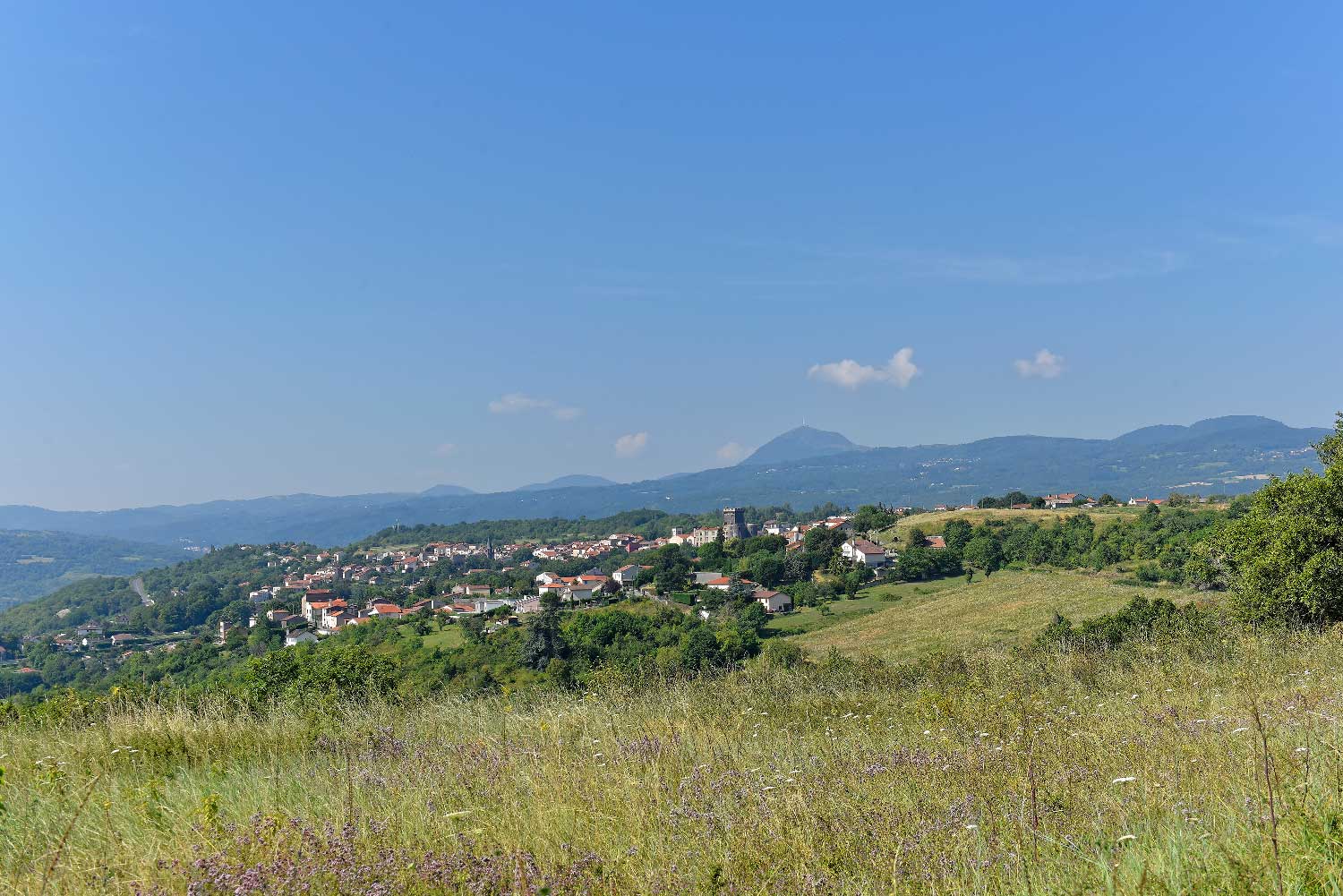
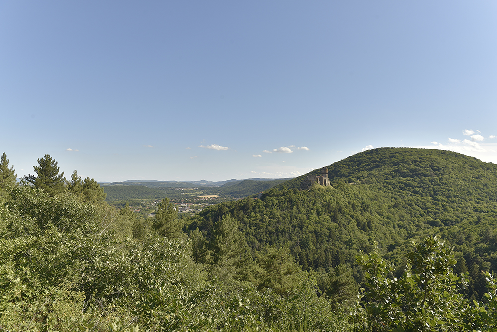
The footpaths exploring the low-lying hills dotting the Limagne Plain have a very different feel, but are no less worthwhile for that. They take you to the mottes of castles long gone that still offer tremendous views, pleasing, bucolic hillsides and the River Allier, one of Europe’s last truly wild great rivers.
Start by climbing the mottes of Montpensier and Montgacon, for breathtaking views of the Limagne Plain and Chaîne des Puys Volcanoes beyond. Here, nature rules the roost and the countryside invites you to let go and soak up the peace and quiet.
Now that you’ve relaxed into your holiday, you can head for Artonne to walk along the flank of Puy Saint-Jean, taking in the nature trail put in place by the Conservatoire des Espaces Naturels d’Auvergne. There is an arboretum and conservation orchard here, and you’ll also learn all about the local winegrowing tradition and history of these Limagne hillsides.
If your ambitions stretch to the long version of this walk in Puy de Dôme, then why not follow the Palm Cross Trail on Puy Saint-Jean ? This hillside walk of around 10 kilometres through unspoilt countryside explores Puy de Bedeuil and the many stone quarries that were once worked there. And the icing on the cake? The stunning sunset you are treated to on a fine day !
By continuing to browse this site, you agree to the use of cookies. Learn more